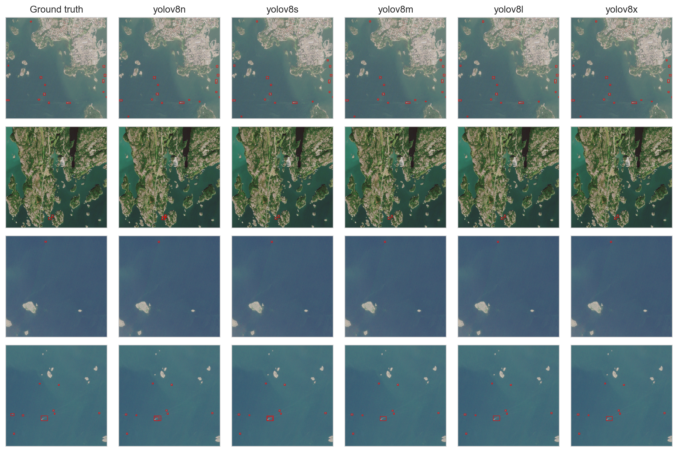
Figure 2: Example result comparison for different models
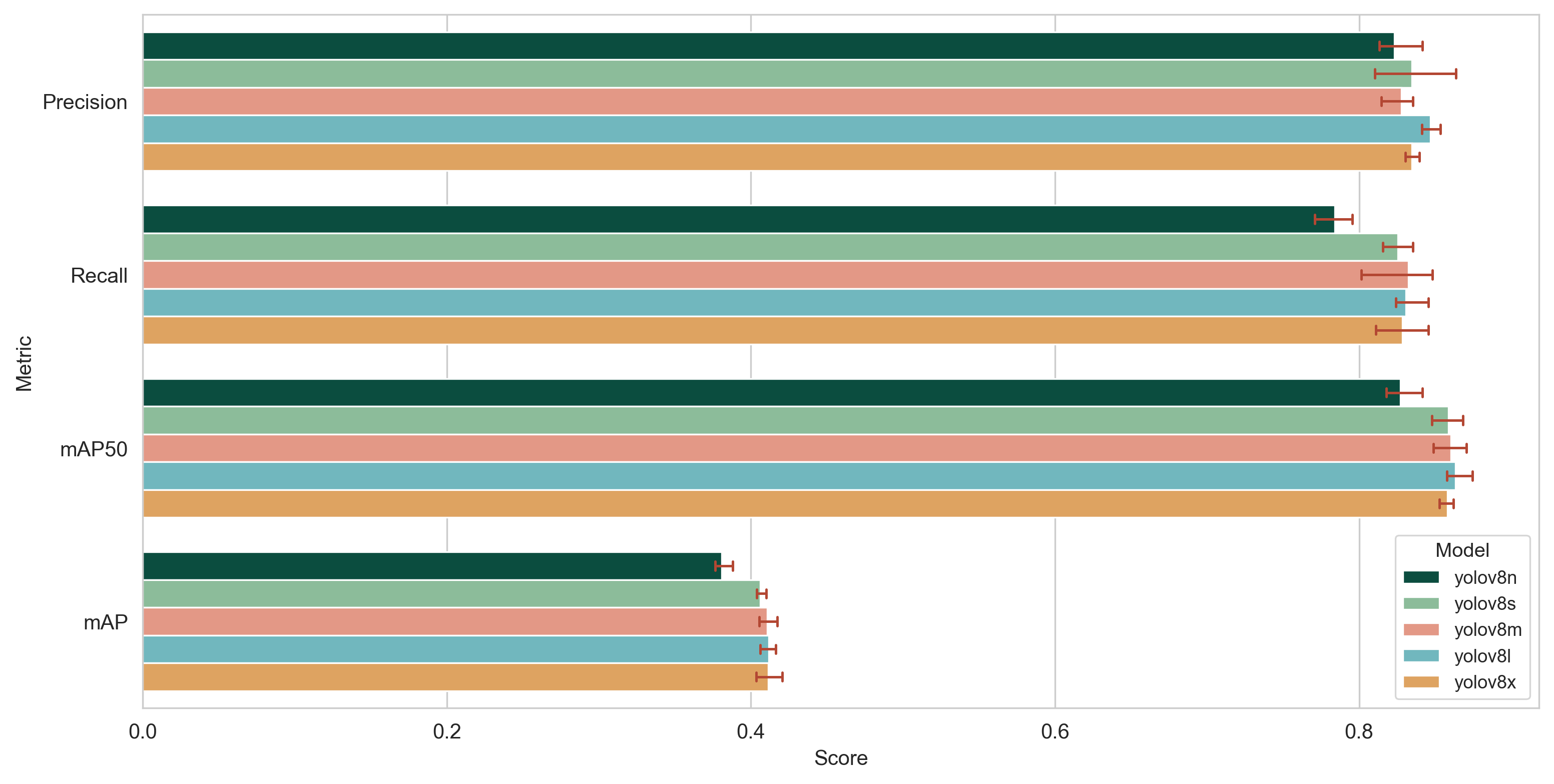
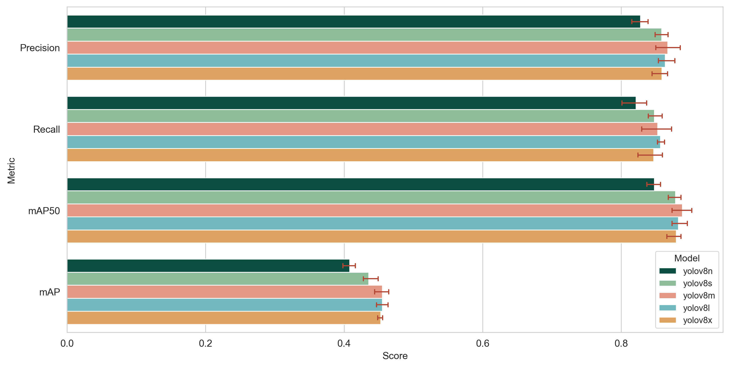
Test set results
The predictions for the test set are cleaned using the following steps:
All prediction whose centroid points are not located on water are discarded. The water mask used contains layers jarvi (Lakes), meri (Sea) and virtavesialue (Rivers as polygon geometry) from the Topographic database by the National Land Survey of Finland. Unfortunately this also discards all points not within the Finnish borders. (The National Land Survey of Finland Topographic Database 04/2023, license CC 4.0 BY)
All predictions whose centroid points are located on water rock areas are discarded. The mask is the layer vesikivikko (Water rock areas) from the Topographic database.
All predictions that contain an above water rock within the bounding box are discarded. The mask contains classes 38511, 38512, 38513 from the layer vesikivi in the Topographical database.
All predictions that contain a lighthouse or a sector light within the bounding box are discarded. Lighthouses and sector lights come from Finnish Transport Infrastructure Agency, ty_njr class ids are 1, 2, 3, 4, 5, 8. (Finnish Transport Agency / Open API, license CC 4.0 BY)
All predictions that are wind turbines, found in Topographic database layer tuulivoimalat
TODO Filter aquaculture and net pens as soon as suitable layer for them is found
All predictions that are obviously too large are discarded. The prediction is defined to be “too large” if either of its edges is longer than 750 meters.
Topographic database can be acquired here, and the data from Finnish Transport Infrastructure Agency is available here (Maritime transport, Aids to navigation).
Evaluate the results with COCO metrics. True positives are defined based on IoU of predicted polygons using shapely.